| |
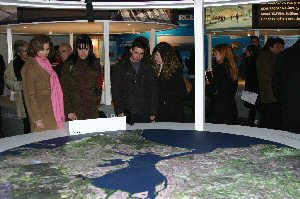
The TTT (Terceira Travessia do Tejo - Third Tejo river crossing) Exhibition was open to the public at "Gare do Oriente" between October 10, 2008 and January 4, 2009, and in Barreiro, on the opposite side of the river Tejo, between January 10 and February 1, 2009.
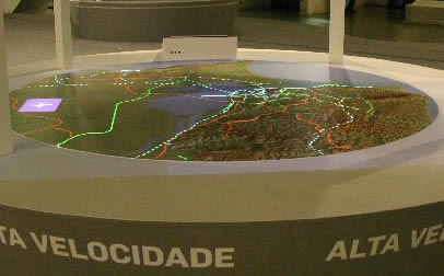
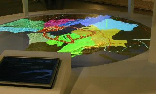
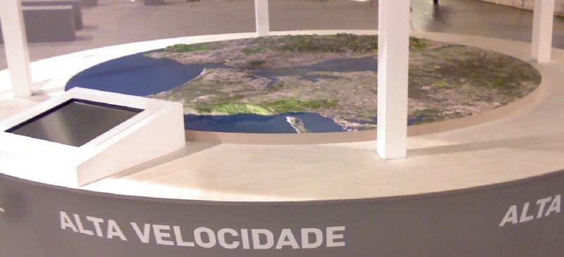
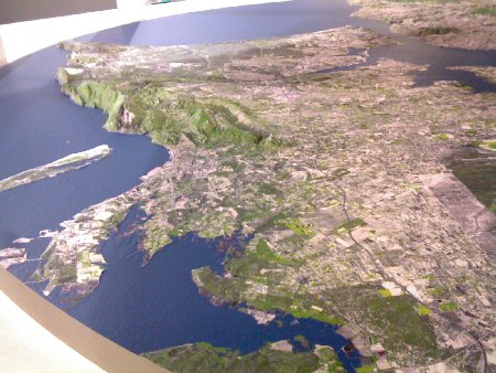
The gison3dmap system that was delivered to RAVE to integrate this exhibition, used a 1:31000 scale and 2.4 meter diameter circular 3D map of the Lisbon Metropolitan Area (AML), printed with a image created from SPOT V satellite images captured on September 25 and October 25, and 4 Sanyo PLC-XU115 video projectors with 4500 Ansi lumens.
The system was installed in a record time of 3 weeks, and initially it used a flat circular map, printed on PVC, with an analytical hill shade created from the AML Digital Terrain model of the AML. Geographic contents were projected on top of this flat map, synchronized with a Powerpoint presentation shown on a LCD computer screen. |
|
| |
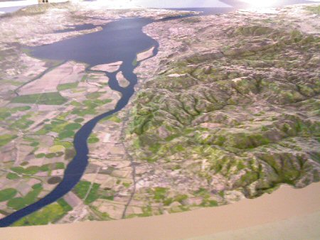
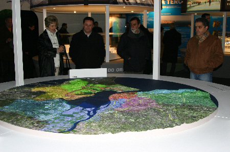
By that time the system parameters were changed for the projection to take place correctly on top of the AML 3D map.
Approximately at the same time, a audio speech was added to the Powerpoint. The combination of these two factors, 3D map and audio greatly increased the attractiveness of this gison3dmap installation. |
|
| |
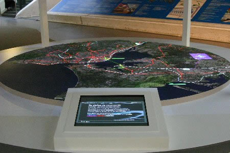
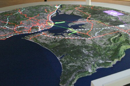
When the Barreiro installation took place, a multimedia interactive application was added to the system. Visitors were now able to navigate within this application using a LCD touch screen and select the TTT geographic contents they wished to see projected on top of the AML 3D map.
After some time of no interaction with the LCD touch screen, the system automatically initiated the Powerpoint presentation, now available in video format, which allows a better synchronization control of the geographic contents projection.
|
|
| |
Beside this system, a portable gison3dmap system was delivered to RAVE, including a 1:32000 scale rectangular 3D map, with 113 x 83 cm, centered on the new bridge.
|
|