If you want to use gison3dmap on a public display, and have people use it, you need to have a simple multimedia application, where one can navigate using intuitive menus, as in a web page, and be able to see, for a specific topic, data projected on the 3D map with a click of a button.
A GIS client will most certainly be too complicated for this purpose, and the Powerpoint client, although easier to use, will be also inadequate.
The use of gison3dmap commandswithin a multimedia application devellopment environment is a very relativelly simple task to acomplish.
As with the Powerpoint client, gison3dmap commands will be captured into text files with the GIS clients.
Then, using the gison3dmap API, it is very easy to integrate system calls into the multimedia application, in order to reproduce the desired map projections.
Alternativelly, you may license the mmon3dmap application – a multimedia gison3dmap client application - that was developed using that same API, to be used as a part of the gison3dmap system by users without any programming skills.
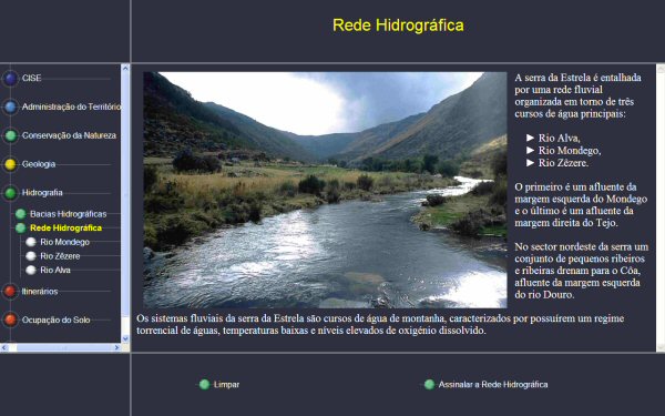
The next image shows an example of a mmon3dmap screen of the multimedia application in use at CISE (Serra da Estrela Interpretation Centre).
|