| |
gison3dmap >> Examples |
|
| |
|
|
| |
The following are examples of the gison3dmap systems currently in use. |
|
| |
|
|
| |
 |
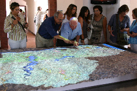
The Guimarães county has since July 5th, 2011, a gison3dmap system wich will be used initially for the presentation and public discussion of the county master plan revision process.
Located on the county headquarters, a XVI century convent, the system will be later used for touristic purposes, as part of the Guimarães 2012 European Capital of Culture.
Learn more >> |
|
|
| |
|
|
| |
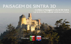 |
CCCGeomática completed on November 2010 the instalation of his 10th gison3dmap system, now for the Parques de Sintra Monte da Lua S.A..
Located closed to the East entrance of the Pena Park, the Paisagem de Sintra 3D (Sintra 3D Landscape) system goal is to offer the Pena Park and Pena Palace visitors, a gobal perspective of the Sintra mountain and of the Sintra World Landscape Heritage, its landscape and its monuments.
Learn more >> |
|
|
| |
|
|
| |
 |
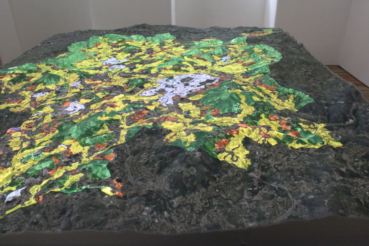
The Batalha County Community Museum is a space dedicated to the history of the Batalha county territory, since the pre-historical times up to the construction of the Batalha Monastery in the XV century, including the Roman presence and a virtual recriation of the ancient Collippo town. In the area "All about us", covering the present time, a 1:10.000 scale interactive 3D solid terrain model of the Batalha county is used to show the natural, cultural, religious and gastronomic routes of the Batalha county.
Learn more >> |
|
|
| |
|
|
| |
 |
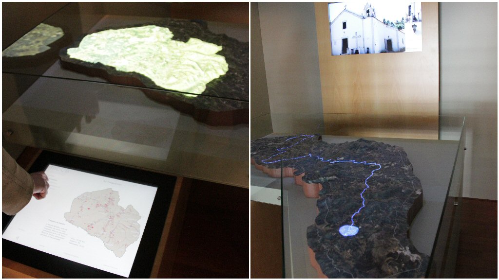
The Territory Interpretation Centre of the "Revelim de Santo António", located in Castro Marim and inaugurated on August 15, 2009, uses a 1:10.000 scale 3D solid terrain model of the Castro Marim county, and a gison3dmap system, to project geographic contents on top of this model, synchronized with a 20 minute video visible on 4 LCD screens, that invites visitors to depart on a journey around the County, to meet their people, know their skills and discover the county natural and historical heritage.
learn more >>
|
|
|
| |
|
|
| |
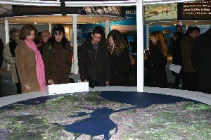 |
RAVE, the company responsible for the high speed railway network project managment in Portugal, used a gison3dmap system with a 2.4 meter circular 3D model of the Lisbon metropolitan area, as part of the TTT Exhibition (the third Tejo river bridge), that was shown to the public first at Gare do Oriente and later in Barreiro, between October 10th, 2008 and February 1st, 2009.
learn more >> |
|
|
| |
|
|
| |
|
|
| |
 |
The Companhia das Lezírias (CL) Interpretation Centre, is located at Coudelaria, in the Ribatejo region, close to Porto Alto. Here, visitors will be able to know all about the CL territory and the many activities that take place in it, by observing the "Herdade da Charneca" 3D map, and the geographic information projected on top it, when navigating on the Charneca multimedia application.
learn more >> |
|
|
| |
|
|
| |
 |
During the 2008 Portuguese National Hunting Fair (Expocaça 2008), the National Forest Services (DGRF) used a gison3dmap system to show visitors the Herdade da Contenda, a National hunting area with 5268 ha located in the Moura county, close to the Spanish border.
learn more >> |
|
|
| |
|
|
| |
 |
At the “Serra da Estrela” Interpretation Centre (CISE), located in Seia, visitors can observe a 3D map of the "Parque Natural da Serra da Estrela", and select on a LCD touch screen the geographic contents they want to see projected on top of this 3D map.
learn more >> |
|
|
| |
|
|
| |
|
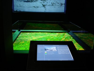
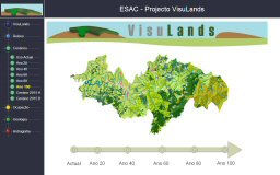
The Coimbra Superior School of Agriculture, used a 1:25000 scale 3D map of the Arganil County and a gison3dmap system, to present the results of the landuse change spatial analysis models developed as part of the VisuLands project.
learn more >> |
|
|
| |
|
|
| |
 |
Melgaço County, the up most North in Portugal, has a gison3dmap system installed at the Lamas de Mouro gateway to the Peneda-Gerês National Park.
learn more >> |
|
|
| |
|
|
| |
 |
The CCCGeomática gison3dmap demonstration system, which uses a 3D map of the Taguspark area, located in the Oeiras County.
learn more >> |
|
|
| |
|
|
| |
^ top |
|
|